
Flint ZIP Code Directory Coverage
Postal delivery is the organizing idea here, not a neighborhood roster. The standard Flint street-delivery ZIP codes appear first because they are the most useful starting points for a full address. The remaining entries identify special mailing, outer-area, or crossover cases that need a USPS address result and a municipality check. Area descriptions are deliberately broad because postal boundaries do not follow a surveyed city line.
| ZIP | Areas Covered | Post Office | Notes |
|---|---|---|---|
| 48502 | Central and downtown Flint, plus nearby city area | Flint-area USPS | Verify the street-level assignment. |
| 48503 | South, east, and central Flint mailing areas | Flint-area USPS | Delivery boundary does not equal the city line. |
| 48504 | West and southwest Flint, including Mott Park-area labels in local use | Flint-area USPS | Historic neighborhood labels can straddle routes. |
| 48505 | Northside and north Flint mailing areas | Flint-area USPS | Use USPS By Address for an exact street. |
| 48506 | East and northeast Flint, with adjacent delivery area | Flint-area USPS | Do not infer municipal ownership from the ZIP. |
| 48507 | South Flint and Grand Blanc-adjacent mailing area | Flint-area USPS | The state map shows a Flint and Grand Blanc context. |
| 48501 | Flint PO-box or special mailing use | Flint-area delivery system | Not a simple residential city-limit polygon. |
| 48531 | Flint-associated PO-box or special use | USPS special-use service | Current station or delivery designation was not confirmed. |
| 48509, 48519, 48529 | Flint and Burton mailing crossover | Flint or Burton-area USPS | Check the exact address and municipality. |
| 48532 | Flint mailing area with southwest or outer delivery context | Flint-area USPS | The official map is approximate. |
| 48550-48557 | Unique, business, or special-use Flint labels | USPS specialized delivery | Do not describe these as neighborhood ZIPs without a USPS result. |
The Michigan ZIP map places 48501 through 48507, 48509, and 48532 in the Flint-area display, with 48509, 48519, and 48529 also appearing by Burton. It is an approximate overview, not a parcel survey. A postal label can remain Flint for an address in a neighboring municipality, while a property inside the city may have a delivery pattern that feels counterintuitive from its neighborhood name.
Flint ZIP Code Directory Postal Basics
USPS assigns ZIP codes for delivery, while Flint and other municipalities define legal jurisdiction. Use the postal result to format and deliver mail, then use the Genesee Parcel History Database to identify the municipality attached to a parcel. The City of Flint GIS map gallery, ward maps, zoning maps, census geography, and tax maps have other purposes. None of those layers should be substituted for one another.
A full mailing address can carry a Flint city label even when the parcel falls in Burton, Grand Blanc, or another nearby area. Conversely, a city parcel may be associated with a ZIP that crosses an adjacent community. A ZIP-wide result therefore describes delivery or a property-filter boundary, not a set of people who live in one legally defined place.
Flint ZIP Code Directory By Address
USPS ZIP Lookup is the source for a specific delivery assignment. Its By Address form accepts a required street address, city, and state, plus optional company, apartment or suite, and ZIP fields. It also offers By City and State to return ZIPs, and Cities by ZIP to return city and state labels. USPS warns that a result does not confirm that a person or company is associated with the address.
| USPS field or mode | Requirement | Use |
|---|---|---|
| Street Address | Required for By Address | Tests a particular delivery location. |
| Apartment or Suite | Optional | Refines a unit-level delivery address. |
| City and State | Required for By Address | Supplies the mailing locality context. |
| ZIP | Optional in By Address | Helps confirm a proposed code. |
| By City and State / Cities by ZIP | Separate modes | Checks postal labels without deciding municipal jurisdiction. |
For an uncertain address, retain the returned form exactly as USPS provides it. Then compare the street and municipality in the parcel record. That two-source check prevents a mailing label from being mistaken for a city-limit finding.
Flint ZIP Code Directory Property Search
The Flint Property Portal guide lists ZIP as a property field and as a custom boundary. It also describes a Download Property List control, selected parcel imagery, a field glossary, property-condition layers, and city or Land Bank data updates for the guide's stated purpose. A ZIP filter can organize a property review, but its result is a set of parcels and attributes. It is not a list of every resident, voter, or household connected with that ZIP.
Flint Property Portal displays the ZIP-capable property and map layer documented in the official guide.
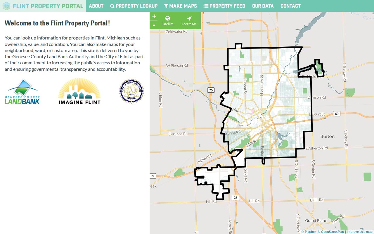
The guide describes more than 60 data points for each of 56,000 Flint properties, a useful scale figure for property research rather than a count of people. ZIP, ward, census-tract, and section boundaries can all be chosen in the portal, so record which boundary was active before comparing results.
Flint ZIP Code Directory Search Steps
A ZIP can narrow a location task, but the most reliable process returns to an address and parcel before drawing a conclusion. The county PHD documents municipality, tax map, deed information, owner name, and address modes, but no ZIP search field was confirmed. The live Flint BS&A destination was gated during research, so its ZIP filtering and export behavior should be checked in the portal rather than assumed.
- Use USPS By Address to verify the delivery ZIP for the actual street address, including unit information when it matters.
- Open the Flint Property Portal and select the ZIP boundary or property field documented in its guide. Note whether the result is a map, a parcel list, or a download.
- Use the Genesee PHD to confirm the municipality, parcel, legal description, and address record. Do not replace that check with the ZIP label.
- For a street-level property sequence after the ZIP is narrowed, use the Flint street directory and keep parcel records separate from civic or historical records.
Michigan's voter-data request geography uses permitted jurisdiction or precinct fields, not a confirmed public ZIP search. ZIP and precinct answer different questions, so a postal code should not be used as a proxy for a voting district.
Flint ZIP Code Directory Geographies
Flint records use overlapping geography. A situs address locates the parcel, a mailing address directs tax correspondence, and a legal description or parcel number stabilizes the research trail when a number changes. ZIP, ward, census tract, map section, and municipality are additional layers with separate boundaries. The City Planning and GIS resources provide official maps, while the PHD ties county parcel history to a municipality and tax map.
The county PHD quick-search examples use municipality and tax-map components such as 1.-1-12 or 1.-1-. Those examples do not establish a universal Flint parcel format. Select the municipality and inspect the returned property record before carrying a number into a deed, permit, or historic map search.
Flint ZIP Code Directory Results
Property portals, parcel databases, and postal tools return different kinds of results. The Flint Property Portal can return property information under a ZIP boundary. PHD returns parcel-history material through its documented municipality and address-oriented modes. USPS returns postal delivery information. A public voter-file request follows Michigan's permitted public-field and geography rules, with protected identifiers excluded. None of those outputs is a comprehensive roster of people within a ZIP.
Use a ZIP as a sorting tool for property and mailing research, then document the record type and date. If the goal is historical address work, a period directory, plat, Sanborn map, or deed legal description may be more meaningful than a modern postal code. The property portal's ZIP field also cannot establish a person as an owner, occupant, or registered voter without an appropriate second record.
Flint ZIP Code Directory History
Older Flint directories often use street addresses without ZIP codes. Preserve the original printed address first, then bridge it with street maps, Sanborn sheets, plats, a stable intersection, adjacent addresses, and the legal description or parcel number. The Flint Public Library house-history resources identify city directories, Sanborn maps, plats, street maps, aerial photographs, deeds, tax records, census material, and a selective Historic Homes Binder as useful context.
No official source inspected established a complete Flint renumbering year or a single annexation-to-number crosswalk. A modern ZIP should be recorded as a later cross-reference, not silently inserted into a historical directory entry. The absence of a matching number is a reason to check maps and parcel evidence, not a reason to assume the old and new addresses are the same.
Flint ZIP Code Directory Boundaries
For Flint, ZIP boundaries are delivery geography and city limits are municipal jurisdiction. The most common local trap is treating a Flint mailing label as proof that a parcel lies inside Flint. Check the PHD municipality for the city or county context, then use the tax map or legal description when the exact boundary matters. PO-box and unique ZIPs can identify a service point or institution rather than a residential neighborhood.
Accuracy check. Do not use a ZIP code alone to classify a Flint address. Verify USPS delivery, the parcel municipality, and the date of the record before relying on a location conclusion.
- ZIP code
- The base postal delivery code used to sort mail to an area or service arrangement.
- ZIP+4
- A four-digit addition that narrows delivery sorting beyond the five-digit ZIP code. It does not define a legal boundary.
- PO-box ZIP
- A postal code associated with post-office boxes or special mailing use, not necessarily a neighborhood of street addresses.
- Carrier route
- A postal delivery sequence used for mail handling. It is not a ward, parcel boundary, or city-limit line.
Note: The exact current use of 48531 and the specialized 48550-48557 assignments was not confirmed in the official Flint sources reviewed, so USPS should supply the final address-level answer.